Reliability+ is a tool developed by Fehr & Peers which transforms data from a variety of transit datasets including automatic vehicle location (AVL) data, Automatic Passenger Counter (APC) data, and General Transit Feed Specification (GTFS) data into a versatile set of transit performance metrics.
Target Areas for Improvement
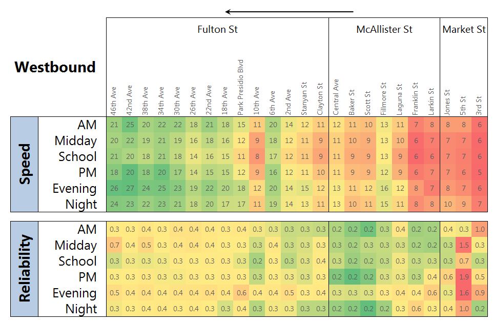
Different metrics can be extracted based on direction of travel, user-defined segment of route, and time of day. Our tool enables users to look at travel time variability (i.e. the coefficient of variation of travel time) and speed by segment in order to pinpoint the specific locations of a route where reliability issues occur. This new approach will enable agencies to target areas of a route for improvement based on the biggest impact on service reliability and travel time.
The output from our tool can be visualized in a variety of ways in order to enable agencies to effectively communicate detailed information to decision-makers and the public. Two sample visualizations are provided below: a simple heat map to quickly identify low-performance areas, and a geo-spatial map to associate the same data in its geographic location. We have also developed time-lapse videos to show the distribution of unreliability over the course of a day and a web map displaying various metrics and allowing user interactivity. Other visuals can be created depending on what is needed on an individual project basis.
The Reliability+ tool and associated innovative visualizations enable us to harness the data to inform agencies of high priority segments for improvement along routes. This tool can be useful for:
Calculating performance metrics
Prioritizing areas for investment
Analyzing before and after studies
Effectively communicating information to agency decision-makers, stakeholders, and the public
Learn more by contacting one of our industry experts.


