Mastering City Curbs
Innovative Tools for Data-Driven, Community-Specific Recommendations
Mastering City Curbs
Innovative Tools for Data-Driven, Community-Specific Recommendations
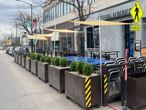
City curbs have become prime real estate. Driven by changes in how people and goods move, especially following the pandemic, this space is no longer just for parking. The curb is an easy place for rideshare service pick-ups, outdoor dining spaces, and places for small vehicles and scooters. Curbside designations can even change and be used in different ways depending on the time of day, day of the week, or shifts in demand, thanks to technology.
This change allows cities to use these areas in creative ways based on how people travel and what their communities need, leading to safer streets, better environmental practices, and more vibrant city streets. But it can be tough for cities to figure out how to make these changes work everywhere. A noteworthy example is the City of Boulder, with whom we recently partnered to develop two valuable tools—an instructive Curbside Management Guidebook and an online decision-making tool. When used together, they make it easier to determine whether to reallocate curbside space from on-street parking to another use and, if so, how to implement it. This approach can be adopted by other communities to make the most of their curbside spaces.
Boulder envisions a stronger balance between current and emerging uses of their curbsides in ways that would increase the number of accessible and connected public spaces as well as the safe and efficient movement of people and goods.
The Curbside Implementation Guidebook
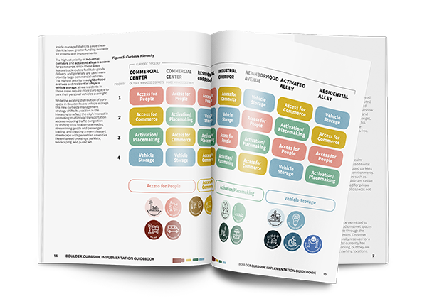
A critical guide for how to manage curbs across the city, specifically focused on curbs in three parts of Boulder called General Improvement Districts (GIDs)– downtown, University Hill, and Boulder Junction.
Informed by community feedback, a peer review, best practices, pilot projects, and recent planning documents, the Guidebook describes a framework and process used to identify how curbs should be allocated in the future. Backed by data and the latest regulations, it then outlines how new curbside uses should be implemented to improve safety, sustainability, economic vitality, and livability. To bolster the framework and support implementation, the Guidebook includes appendices to:
Provide a cut sheet for each curb use, including pricing, descriptions, enforcement considerations, time restrictions, cost estimates, implementation resources, and design considerations.
Prepare for future technologies like autonomous vehicles, smart cities, dynamic curbside management, and emerging mobility options, aiming to optimize curb space use and encourage positive outcomes.
Examine pricing strategies for various curb uses, including loading zones, transitioning from free to static or dynamic pricing for curbside uses other than parking.
Offer a data-driven framework for new managed parking areas, using case studies to determine timing restrictions and pricing, aligning with existing programs.
Piloting Flexible Loading Zones
As a part of the Curbside Management Plan, Boulder tested several Flexible Loading Zones to replace traditional loading zones in two of the GIDs. These spaces can be used for various purposes including deliveries, short-term parking, and rideshares, as long as dwell time is less than 15 minutes. The city studied before and after data (e.g., crashes, dwell time, usage, citations, community complaints, etc.), found it successful, and recommended formalizing Flexible Loading Zones as the default loading curb designation , especially where multiple users are demanding access to the curb. Detailed implementation scenarios and guidance around education and coordination with rideshare companies are provided in the Guidebook.
The Online Tool
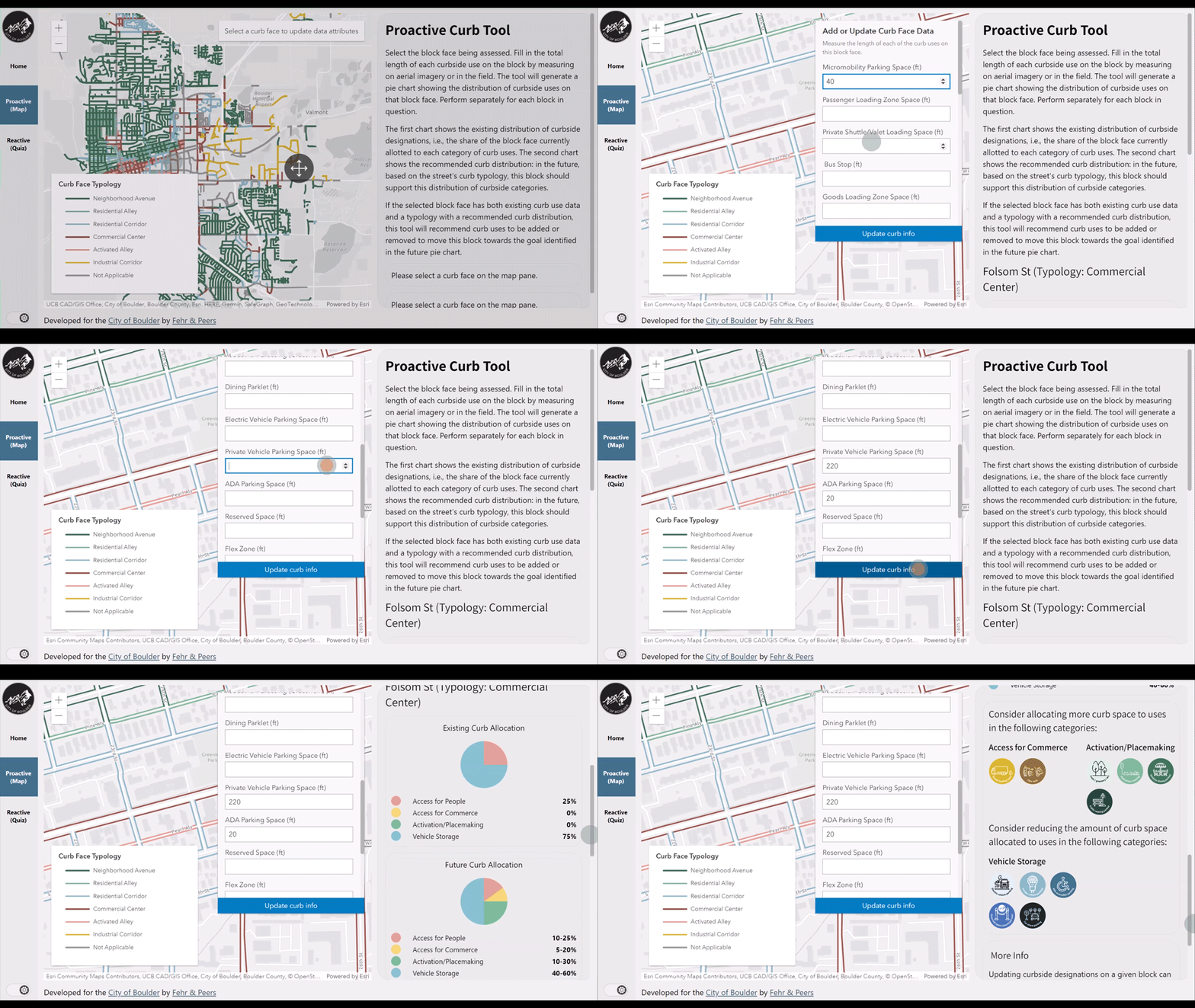
Designed to accompany the Guidebook, this dynamic tool supports the city in determining how to reallocate curb space to meet the city’s ultimate vision.
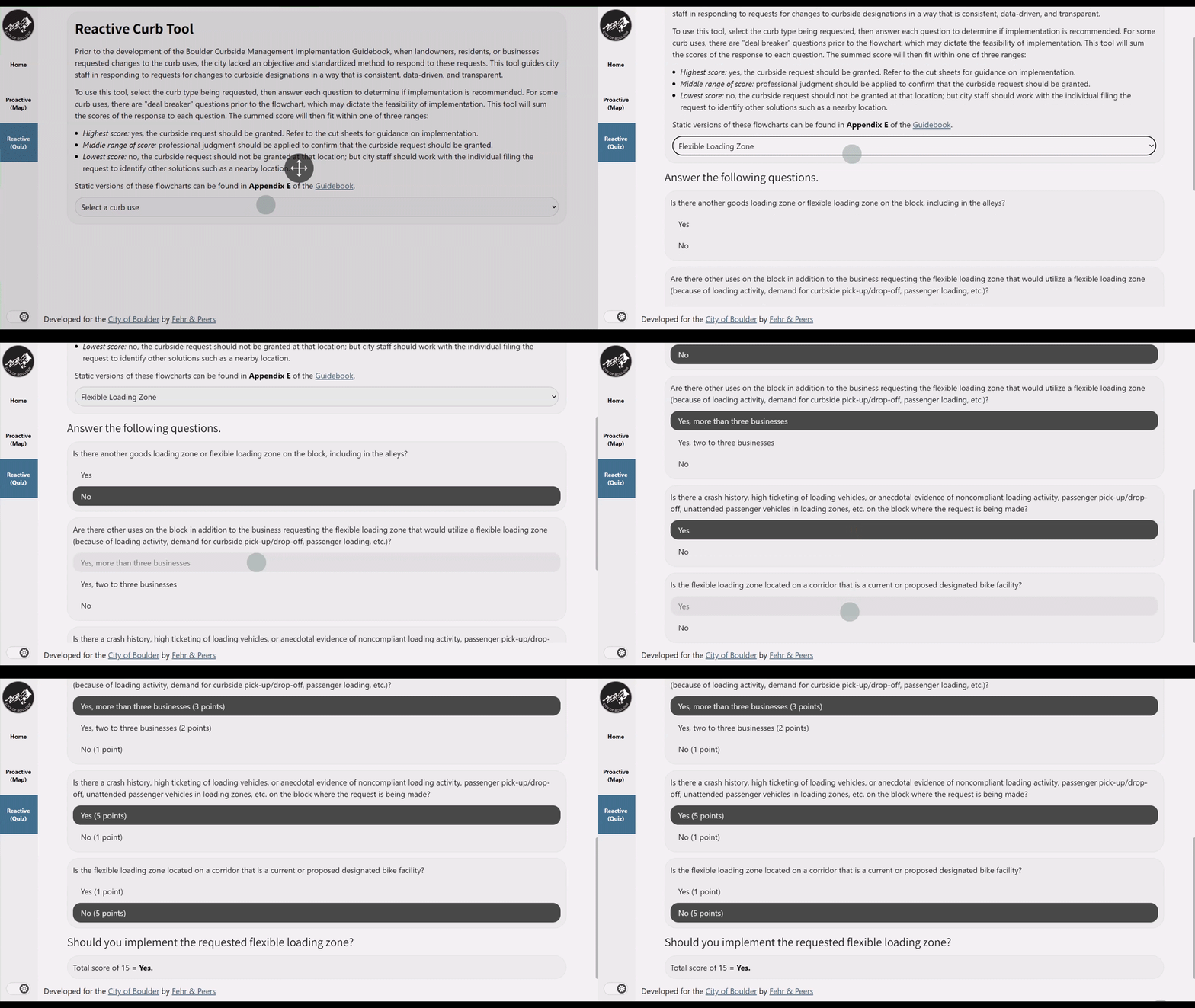
Using data and interactive maps to suggest improvements, city staff can use this tool to decide on changes in advance that would reduce accidents or address resident complaints. They can respond to incoming requests from residents, landowners, or businesses who want changes to the curbside setup. Once the tool helps them choose the best options, it provides instructions on how to carry out those changes, making the decision-making process smoother and more efficient.
The tool will be a big win for the city and has allowed staff to manage curbs in a way that’s transparent, data-driven, consistent over time, and equitable for business owners.
– Chris Hagelin, Principal Planner, City of Boulder Transportation & Mobility
Anchored toward its vision with the Guidebook and online tool in hand, the City of Boulder will be well-equipped to make consistent and systematic changes to its curb space in the years to come.
As we continue at the forefront of curb research and analysis, our curbside management practice will continue to bring together expertise from each of our service lines and apply that to how and where things intersect the curb. This unique and valued knowledge base will help cities like Boulder make informed decisions about their curbs in ways that are cross-disciplined, defensible, and data-driven. If your jurisdiction needs help with curb space planning, reach out to us!
-Valerie Watson, Transportation Planning Manager, City of Boulder Transportation & Mobility

Carly Sieff
Senior Associate
Email Me

Annie Rice
Transportation Planner

Jess Sandoval
Senior Planner


